 EMODnet Product Catalogue
Coastal geomorphology
Type of resources
Available actions
Topics
Keywords
Contact for the resource
Provided by
Years
Formats
Representation types
Scale 1:
Resolution
-
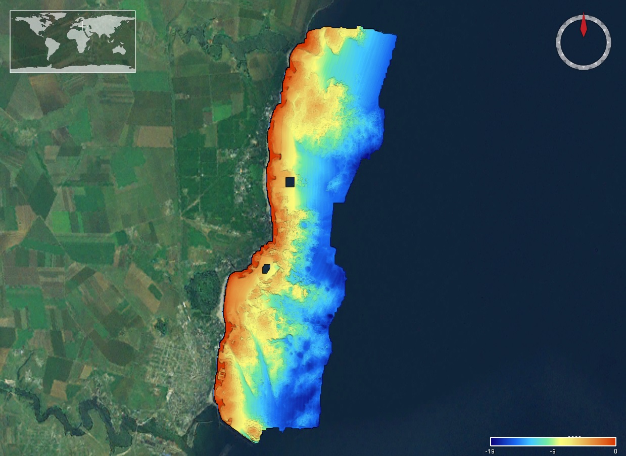
The DTM is produced with Kongsberg multibeam echosounder survey, acquired in March 2020 by Marine Research Ltd. The resolution is 1/256 arc-minutes (~7.2m). It is located at Tuzla, Romania, on the coastal region of the Black Sea. Depths are referenced to the Local Sea Level - Marea Neagra 1975 and the coordinates are expressed into the WGS84 reference frame.
-
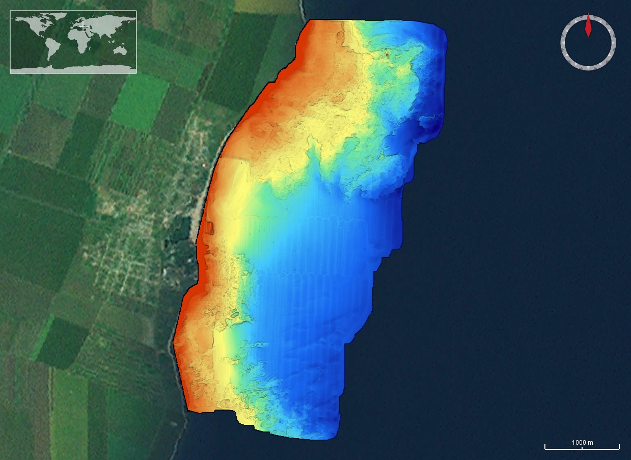
The DTM is produced with Kongsberg multibeam echosounder survey, acquired in 2015 by Marine Research Ltd. The resolution is 1/256 arc-minutes (~7.2m). It is located in Costinesti, Romania, on the coastal region of the Black Sea. Depths are referenced to the Mean Sea Level and the coordinates are expressed into the WGS84 reference frame.
-
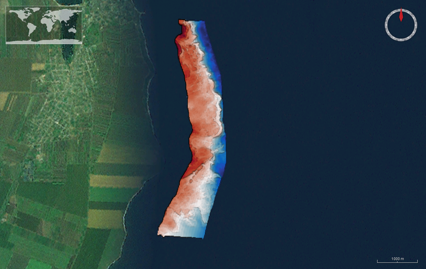
The DTM is produced with Kongsberg multibeam echosounder survey, acquired in March 2020 by Marine Research Ltd. The resolution is 1/256 arc-minutes (~7.2m). It is located at 23 August, Romania, on the coastal region of the Black Sea. Depths are referenced to the Local Sea Level - Marea Neagra 1975 and the coordinates are expressed into the WGS84 reference frame.
-
The DTM is produced with Kongsberg multibeam echosounder survey, acquired in 2015 by Marine Research Ltd. The resolution is 1/256 arc-minutes (~7.2m). It is located south of Constanta Port, Romania, on the coastal region of the Black Sea. Depths are referenced to the Mean Sea Level and the coordinates are expressed into the WGS84 reference frame.
-
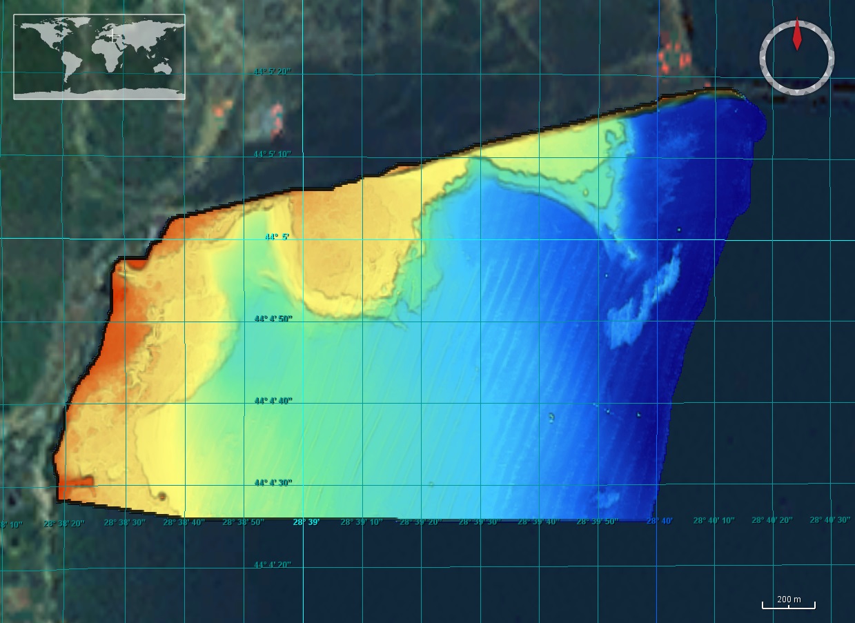
The DTM is produced with Kongsberg multibeam echosounder survey, acquired in 2015 by Marine Research Ltd. The resolution is 1/256 arc-minutes (~7.2m). It is located north of Mangalia Port, Romania, on the coastal region of the Black Sea. Depths are referenced to the Mean Sea Level and the coordinates are expressed into the WGS84 reference frame.
-
The dataset contains circalitoral habita types in the Slovenian coastal area. It contains the description of habitat types, EUNIS codes, areas of the habitat and the key species described.
-
This dataset contains the pressure and temperature data acquired below seafloor by piezometer SPF-PZ3L since October 2015 following its deployment during the (ESS_PENF50_2015 cruise)-[https://doi.org/10.17600/15010900] . It operated in an autonomous mode until its connection to the EMSO-Ligure Nice cabled observatory on the 14/09/2016. Sediment pore pressure together with temperature have been measured at 20 different levels below seafloor as shown in the following table: Image Reference: https://www.seanoe.org/data/00404/51528/illustrations/illustration-194.gif. Important Note: This submission has been initially submitted to SEA scieNtific Open data Edition (SEANOE) publication service and received the recorded DOI. The metadata elements have been further processed (refined) in EMODnet Ingestion Service in order to conform with the Data Submission Service specifications.
-
This dataset contains the pressure and temperature data acquired below seafloor by piezometer ST4-PZ2L-01B since January 2014 following its deployment during the (STEP 2014 cruise)-[https://doi.org/10.17600/14005400]. It operated in an autonomous mode until its connection to the EMSO-Ligure Nice cabled observatory on the 14/09/2016. Sediment pore pressure together with temperature have been measured at 6 different levels below seafloor as shown in the following table: Image Reference: https://www.seanoe.org/data/00403/51490/illustrations/illustration-195.gif. Important Note: This submission has been initially submitted to SEA scieNtific Open data Edition (SEANOE) publication service and received the recorded DOI. The metadata elements have been further processed (refined) in EMODnet Ingestion Service in order to conform with the Data Submission Service specifications.
-
This dataset contains the pressure and temperature data acquired below seafloor by piezometer ST4-PZ2L-03 since January 2014 following its deployment during the (STEP 2014 cruise)-[https://doi.org/10.17600/14005400]. It operated in an autonomous mode until its connection to the EMSO-Ligure Nice cabled observatory on the 13/09/2017. Sediment pore pressure together with temperature have been measured at 7 different levels below seafloor as shown in the following table: Image Reference: https://www.seanoe.org/data/00404/51529/illustrations/illustration-196.gif. Important Note: This submission has been initially submitted to SEA scieNtific Open data Edition (SEANOE) publication service and received the recorded DOI. The metadata elements have been further processed (refined) in EMODnet Ingestion Service in order to conform with the Data Submission Service specifications.
-
Multibeam imagery was collected with a Elac Seabeam 1185 echo sounder in March 2010. This multibeamecho sounder has beams as narrow as 1,5 x 1,5 degrees and a swathwidth in excess of 150 degrees. The data were corrected for heading, depth, pitch, heave, and roll with a redundant Meridian TSS/MAHRS system and with the Port Motril tidal gauge records.